|
PAPILA
Prediction of Air Pollution in Latin America and the Carribean
Project summary
The overall objective of the PAPILA project (Prediction of Air Pollution in Latin America and the
Caribbean) is to establish a sustained network of partners with complementary expertise that develops
and implements an analysis and forecast system for air quality with downscaling capability for Latin
America and the Caribbean region (LAC region), and to assess the impact of air pollution (background
and peaks) on health and on the economy. This system will help decision-makers improve air quality and
public health, and avoid the occurrence of acute air pollution episodes, particularly in urban areas.
The project combines for the first time an ensemble of state-of-the-art models, high-resolution emission
inventories, space observations and surface measurements to provide real time forecasts and analysis of
regional air pollution in the LAC region. To reach this objective, the project will bring together an
interdisciplinary team of scientists from Europe, Latin America (Argentina, Bolivia, Brazil, Chile,
Colombia, Mexico, Venezuela) and the Caribbean (Puerto Rico), and foster synergies between the groups
involved in research and service activities. The project will co-develop with users and other stakeholders
several products and services of importance for the LAC region. An important objective of the project is
to make use of complementary competence to develop innovative ideas, to establish sustained
partnerships between research groups, to transfer information to the public, to develop educational
activities and to create a dialogue with interested stakeholders. Societal impacts, specifically on human
health and on crop production will be assessed. Economic benefits of mitigation policies will be
quantified. Finally, the planned activities will provide the basis for education and capacity building, and
contribute to career development.
M1=January 2018.
Contribution of CNRS (with LMD and LA)
| WP
| Title
| Lab.
| Deliverable
| End date
| Lead
|
| 2.1
| Adaptation of individual models to regional conditions
| LMD
| M24
| January 2020
| MPG and USP
|
| 2.3
| Setting up an AQ forecast chain for the common area and high-resolution sub-domains
- Task 2.3.1.
Common-area AQ forecasting ensemble for Latin America.
Lead: FMI and UNAM
- Task 2.3.2.
High-resolution AQ forecasting for zoomed regions.
Lead: CNRS (LMD) and UCL
| LMD
| M36
| January 2021
| MPG and UCL
|
| 3.1
| Definition of a preliminary surface emissions dataset to be used in the first year of Papila
| LA
| M9
| October 2018
| CNRS and CNEA
|
| 3.2
| Evaluation of all publicly available data concerning anthropogenic emissions in Latin America
| LA
| M24
| January 2020
| CNRS and UNAL
|
| 3.3
| Definition of a Latin America regional inventory.
| LA
| M36
| January 2021
| CNRS and USM
|
| 3.4
| Evaluation of the Papila version 1 emissions inventory
| LA
| M42
| July 2021
| CNRS and UNAL
|
| 3.5
| Final version of the anthropogenic emissions inventory for Latin America
| LA
| M48
| January 2022
| CNRS and UCL
|
| 5.2
| Development of a common database for observations
| LA
| M12
| January 2019
| CNRS and UPR-RP
|
| 5.3
| Validation of Air Quality Forecasts
- 5.3.1 Methodology. Lead: CNRS and CNEA
- 5.3.2 Model Validation. Lead: CNRS and USP
| LMD
| M40
| April 2021
| CNRS
|
| 6.3
| Courses and training for early-stage researchers and capacity building
| LA
| M23
| December 2019
|
|
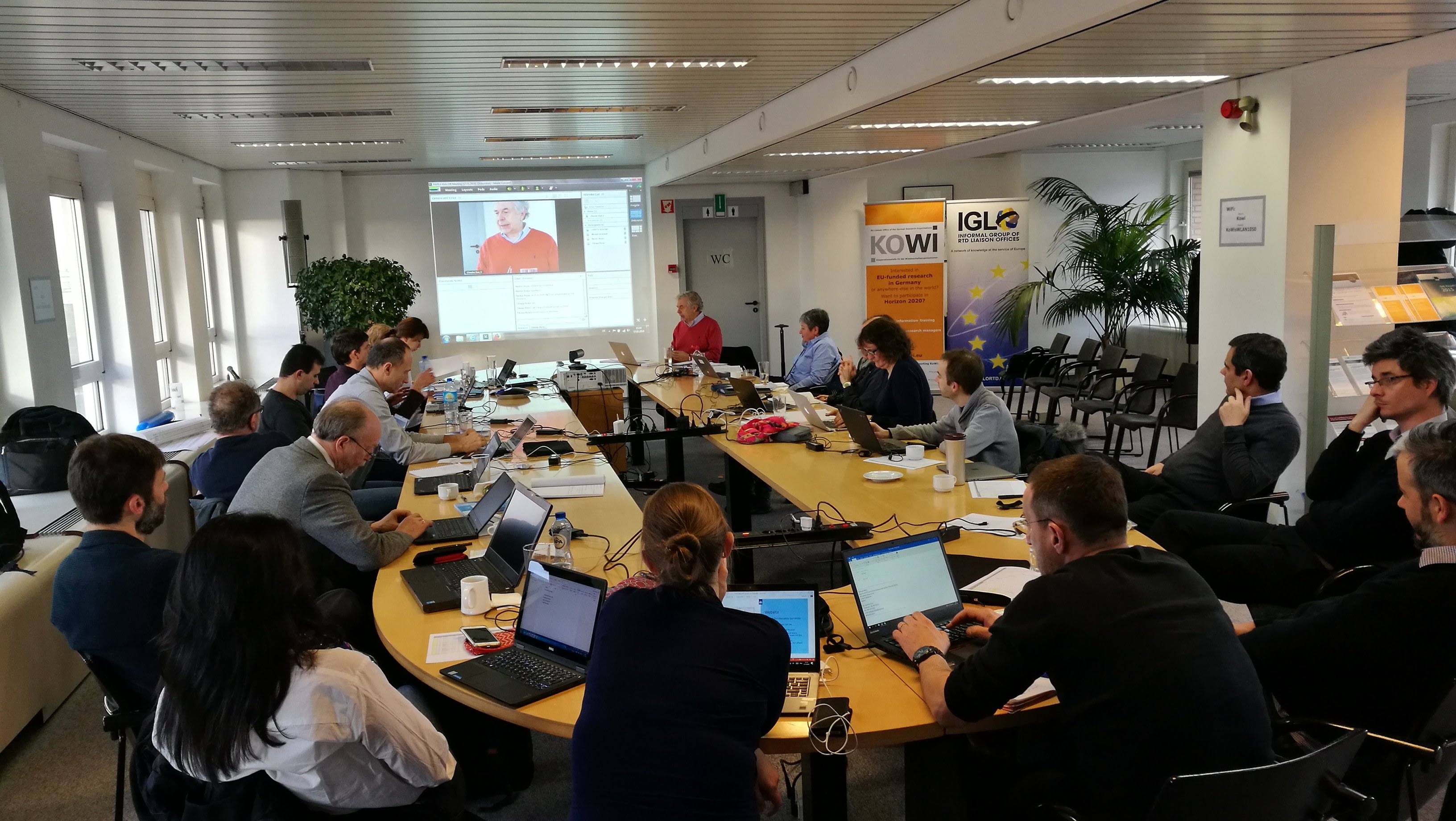
Kick-off meeting in Brussels, january 2018
The presentation of the WP5 modeling (PDF)
WP2 Development of Modelling Framework
CNRS: 3 PM
Main deliverables:
- D.2.1. [Month 24]: Updated regional models verified in Latin America and Caribbean
- D.2.2. [Month 36]: Re-analysis of AQ in Latin America for the 21st century
- D.2.3. [Month 36]: Forecasting modelling suites
- D.2.4. [Month 48]: Downstream AQ-based products for regional agriculture and public health
Description of Milestones
- M.2.1. [Month 24]: Results of updated regional models verified in Latin America and Caribbean available
- M.2.2. [Month 36]: Re-analysis of AQ in Latin America is finished and verified successfully
- M.2.3. [Month 36]: Forecasting modelling suites are installed and tested
Objectives
The overall objective of WP2 is:
To develop a modelling framework to predict air quality (AQ) and related health indices in Latin
America, specifically in industrialized regions and metropolitan areas, by using an ensemble of
multi-scale chemical-transport models
To share technology, tools and datasets and on making them available and sustainable over long-
term.
Specific goals are:
To develop a multi-scale modelling ensemble chain (global-regional-urban) for Latin America by
adapting the Papila models to the regional conditions and evaluate the models using remote sensing
and ground-based observations made available by WPs 4 and 5
To perform AQ assessments in Latin America and develop a zooming capability towards the
industrialized and densely populated areas as well as hotspots characterized by particular conditions
such as complex topography (e.g., Andes)
To set a downscaling air quality forecasting chain as a service for selected megacities and urban
agglomerations
To provide the data required for the Papila outreach applications (related to e.g., regional
agriculture, public health, etc.)
Description of Work and Role of Specific Beneficiaries / Partner Organisations
The following models will constitute the ensemble analysis and prediction system:, the regional online
NWP-CTM WRF-Chem (MPG), the global-to-regional offline CTM SILAM (FMI), and the regional offline
CTMs EMEP MSC-W (MET Norway) and CHIMERE (CNRS) models. In most cases global-scale
information needed to formulate boundary conditions for the regional simulations, will be provided by the
global online NWP-CTM model C-IFS of the European Centre for Middle range Weather Forecasts
(ECMWF). All models will be applied at low spatial resolution to a common domain covering the whole
Latin America with individual high-resolution zooming sub-domains (hotspots) defined around key
industrial areas and megacities. The larger Latin American area (common domain) will provide boundary
conditions for the high-resolution zooms. High-resolution simulations in the hotspots will also be performed
by systems already exploited by Latin American institutes, which will be also nested in the large-scale
model simulations.
Task 2.1. Adaptation of individual models to regional conditions.
Lead: MPG and USP
To improve and evaluate the models performance in Latin America, the following major challenges will be
considered by all models: (i) complex-terrain topography with major industrial sources located in valleys of
the western part of the continent, (ii) close proximity of Andes mountains and west-side coastal line with
complicated large-scale meteorological phenomena, such as coastal troughs and passage of frontal systems
(iii) tropical conditions with deep convection in the northern part of the domain, (iv) vast forested areas in
central and eastern parts of the continent where biogenic and biomass burning emissions are dominant, (v)
representation of the megacities and urban areas near coastal areas in Atlantic and Pacific Coasts. The
model resolution for the common domain (0.1-0.3 degree depending on the model \u2013 see tasks 2.2-2.3) will
not allow for explicit treatment of the topographic details and some of the meteorological phenomena.
Therefore, a careful distinction between the resolved and unresolved spatial scales and processes will have
to be made in each model.
The major effort in the task will be put on evaluation of the models against the in-situ and remote-sensing
data provided by WPs 4 and 5. Easily accessible datasets from European and US satellite instruments will be used at the earlier stages of the project, with additional in-situ information and advanced remote-sensing
observations being involved upon their availability following the WPs 4 and 5 recommendations and
delivered data. The work will be performed primarily in the institutes providing the models, but with a
strong involvement of Latin American scientists via secondments from Latin American partners. Substantial
activity will also take place in Latin American institutes where the models will be installed with the support
of European model developers via the corresponding exchange visits.
Task 2.2. Re-analysis of AQ in 21st century in Latin Americas.
Lead: FMI and UMSA
In close coordination with Task 2.1 and WPs 3 (surface emissions), 4 and 5 (in-situ and remote-sensing
observations), a 10-year-long re-analysis covering the second decade of the 21st century (2010-2020) will
be performed for the common domain. The objective is to create a state-of-the-art archive of the AQ
information for Latin America, which will be used for downstream applications of Task 2.4 and for the
project outreach in WP 6. The spatial resolution of the re-analysis will be at least 40 km, thus resolving the
major industrial and megacity areas, and reflecting the impact of the development of such populated areas
during the industrialization and urbanization period. Major trends related to these processes, as well as to
continuous deforestation and intense biomass burning will be highlighted and compared with observational
information. The differences and similarities between the models involved in the re-analysis will be
evaluated and consensus AQ estimates will be provided. It is anticipated that the bulk of work will be
performed in the European supercomputing centres, which possess the necessary computational resources
and input data. The transfer of knowledge will be ensured via the project secondments with visits of the
Latin America scientists who will contribute to the re-analysis by using the infrastructure of the European
model developers.
Task 2.3. Setting up an AQ forecast chain for the common area and high-resolution sub-domains.
Lead: MPG and UCL
Completion of the model re-analysis and its evaluation will pave the way for setting up the pre-operational
automated AQ forecasts for Latin America. The work will be closely integrated with the existing forecast
efforts already in place in the region, so that the Papila effort will complement the on-going activities by
providing improved input and boundary conditions for local efforts. Support for the models currently used
in the region will be provided. The products derived by the models will include the atmospheric
concentration of particulate matter (PM 2.5 , PM 10 ), dust particles, of black carbon, sulphates, nitrates, primary
and secondary aerosols, and the concentrations of reactive gases such as CO, NO x , VOCs and ozone.
Task 2.3.1. Common-area AQ forecasting ensemble for Latin America. Lead: FMI and UNAM
Using the newly compiled emission inventory from WP3 and assimilation of the near-real-time available
satellite and in-situ data from WP4 and WP5, a common-area forecast will be established that covers the
whole area of Latin America with spatial resolution of at least 25 km (depending on the computational
capacity of the participating institutes). The models will be primarily established on the basis of European
data provider's infrastructure during the secondment visits from Latin America. Using the results of the
model evaluation and experience of CAMS, a multi-model ensemble will be produced to provide the robust
AQ forecast and boundary conditions for the high-resolution forecasts of Task 2.3.2. An effort will be made
jointly with WP4 to arrange a near-real-time evaluation of the forecasts using the remote-sensing products
already tested by Copernicus global evaluation within CAMS. Surface observations available in near-real-
time will also be used, following the inventory and recommendations of WP 5.
Task 2.3.2. High-resolution AQ forecasting for zoomed regions. Lead: CNRS and UCL
Using the common-area forecasts of Task 2.3.1 as regional boundary conditions and the newly compiled
emission inventory from WP3, high-resolution forecasts will be made first for the large urban areas in
which a large number of existing observational networks will provide data for model validation (Sao Paulo,
Rio de Janeiro, Buenos-Aires, Santiago, Bogota, Mexico, La Paz). Other cities, specifically highly polluted
cities, will be considered in a later phase of the project. The list of high-resolution systems includes both the
zoomed applications of the models from the Task 2.3.1 and local installations exploited in the
corresponding countries (SILAM by UNAM, possibly also IAG-USP, WRF-Chem by UNAL, CHIMERE
by UCL, etc.). Evaluation of these forecasts will be mainly based on local in-situ observations following
WP5 and data provided by Latin American partners.
Task 2.4. Downstream applications: Impacts.
Lead: INERIS and IVIC
The purpose of the task is to construct a series of example user-oriented downstream applications based on the AQ reanalysis and forecasts. The created applications will be provided to the project outreach WP 6.
Task 2.4.1. Crop damage model.
Lead: INERIS and UCL
The task will revisit the studies on the impact of ozone on agricultural ecosystems by replacing the widely
used but over-simplified annual Accumulated Ozone over a Threshold (AOT) indicator with a new one
accounting for stomatal ozone uptake under different hydrological stress: Photolytic Ozone Dose, POD. The
task aims at developing the modelling suite to quantify and monetize the effects of tropospheric ozone on
the productivity of crops and forests using the stomatal fluxes-based approaches; and monetizing the
impacts of ozone on yields in Europe and Latin America. The methodology will first be developed on a
European domain where the required data are well known. In a second stage, it will be applied on a Latin
American domain, as part of secondments exchanges between the different countries.
Task 2.4.2. Population exposure models and Health Indices.
Lead: FMI and UNAL
The high-resolution AQ assessment and forecasts will form the basis for the numerical population exposure
modelling. Based on static and time-resolving population movement, combined with a concept of micro-
environmental population modelling, applied in deterministic and probabilistic exposure models,
assessments will be generated for the main megacities of Latin America. Air quality health indices and
health outcomes (e.g., expected mortality) will be derived from the calculated/predicted concentrations of
pollutants, and made available in real time to potential users (health institutions). A comparison will also be
carried out with a model (ESCAPE) in which land use regressions have been applied for the same purpose.
The analysis will include model sensitivities to uncertainties in various inputs and integration with the
exposure determinants for the epidemiological studies. Information on concentration-response functions for
health impacts related to air pollution exposure will be collected, as well as statistics on country specific
population and health impacts. Literature and data available to assign monetary unit values to the identified
health impacts will also be gathered.
Task 2.4.3. Impact of Air quality on human health and calculation of risks and benefits.
Lead: INERIS and UCL
This task aims at extending the modelling suite to quantify and monetize the health impacts from the
exposure of the population to emissions of fine particulate matter, ozone and possibly nitrogen dioxide. The
basic methodology exists for Europe in which the project primarily aims at improving available data and
possibly extending the tools to health impacts not yet covered. For Latin America the project aims at
developing a tool capable of quantifying and monetizing air pollution related health effects based on region
specific data. Individual and regional costs estimates will be provided for a selected health effects.
Role of Specific Beneficiaries / Partner Organisations
MPG, CNRS, FMI and MET Norway will provide the models that will constitute the ensemble analysis and
forecast system. These models will also be used for the re-analysis activity. UCL, UNAM and USP will
install high-resolution versions of regional models on their institutes in order to provide and deliver local
forecasts. INERIS and UCL will assess the impacts of air pollution on crop productivity, while INERIS,
UCL and FMI will derive the population exposure and the health impacts. INERIS will calculate the
economic benefits of improving air quality.
WP3 Surface emissions
CNRS: 15 PM
Main deliverables:
- D3.1 [Month 9]: "Best preliminary" gridded emissions inventory for 2010
- D3.2 [Month 24]: A first version of an inventory of emissions for Latin America at a .1x.1
degree for 2010
- D3.3 [Month 36]: Peer-review community paper on the inventory and its evaluation
- D3.4 [Month 42]: Final Papila emissions datasets up to 2020
- D3.5 [Month 48]: E-training tools on emissions available on the project website
List of Milestones:
- M3.1 [Month 3]: Discussions among the partners to define the "Best preliminary" dataset to be used
in the simulations
- M3.2 [Month 18]: All gathered datasets concerning emissions or ancillary data for South America
publicly available on the Papila website
- M3.3 [ Month 38]: Discussions on the establishment of the final emissions dataset
Objectives
The main goal of WP3 is:
To provide the surface emissions necessary for the work planned in the other WPs
To develop of an inventory of surface emissions for Latin America
To analyze different datasets providing emissions or ancillary data in Latin America
To develop e-training sessions and tools for the users of the datasets
Task 3.1: Definition of a preliminary surface emissions dataset to be used in the first year of Papila.
Lead: CNRS and CNEA
In the first six months of the Papila project, a preliminary dataset to be used in the model simulations will
be defined. This dataset will be chosen, based on an evaluation of the datasets already existing at the global
scale. Several anthropogenic emissions inventories were developed in the past few years, which provide
emissions of several gaseous and particulate compounds at the global scale. These datasets will be
identified during the secondments or through email/telecons exchanges, then collected, compared and
evaluated for Latin America, using the expertise of local Papila partners. The most appropriate and
consistent emissions for each compound considered in the simulations will be identified, which will lead to
the definition of a first inventory to be used in Papila. The same work will be done for dataset providing
emissions from fires. The collection of the datasets and the completion of the first version of the Papila
emissions inventory will be completed as part of the secondments between CNRS and CNEA.
Task 3.2: Evaluation of all publicly available data concerning anthropogenic emissions in Latin
America.
Lead: CNRS and UNAL
In Latin America, there are many data available concerning anthropogenic emissions in different cities and
regions, but they all are in different formats and not always easily available: the local efforts in different
cities and regions in Latin America to develop local emissions inventories will be taken into account in this
task. The different Papila partners will work together during the different secondments to gather all
available data on surface emissions for different species (gases and particles) and for different emission
sectors. Both gridded and non-gridded data will be considered. All the data will be converted into a
common format, and will be made available to the consortium on the internal pages of the project website,
so that all the partners can easily access the data. This task will also gather data on emission factors for
different emission sectors, as well as information on VOCs speciation, daily/seasonal/yearly data that could
help define the short and seasonal variation of the emissions. Data on speciated volatile organic compounds
will also collected, in order to define a speciation of the emissions total volatile organic compounds that is
provided by most inventories. Training and expertise on the calculations of emissions, formatting of data
and use of NetCDF files will be provided during the exchanges between staff. This work will be done
during the secondments between CNRS, UNAL and USM.
Task 3.3: Definition of a Latin America regional inventory.
Lead: CNRS and USM
The data gathered in Task 3.2 will be merged into the "best preliminary" inventory defined in Task 3.1 to
become the Papila version1 emissions inventory. The data gathered in Task 3.2 will cover only several
regions or cities in Latin America, and we propose to merge these scattered data into the 0.1x0.1
preliminary inventory. In order to achieve this work, the different partners will develop a methodology for
merging these data. The target time period covered by this inventory will be 2005-2020. The resulting
dataset will provide emissions on a monthly basis and some information on daily/weekly variations will
also be available. Results obtained in Task 4.1 on the basis of satellite data will help better define these
temporal variations. The Latin America regional inventory will be developed during the secondments
between CNRS and USM, UNAM and UCL.
Task 3.4 : Evaluation of the Papila version 1 emissions inventory.
Lead: CNRS and UNAL
The inventory developed in Task 3 will be evaluated in details using the results of the simulations
performed in the Papila workpackages as well as using the results from WP4 on inverse modelling. The
anthropogenic emission inventory and the emissions from fires will also be evaluated using the most recent
work done by different international groups on the development of global emissions inventories. This work
will help quantify the uncertainties on anthropogenic and biomass burning emissions: a statistical analysis
of available data will lead to a quantification of the uncertainties on the emissions of each species. Within
this task, the MPG, CNRS, UNAM and USM partners will work during the different secondments on the
analysis of the datasets and on a community peer-reviewed paper presenting the inventory developed as
part of Papila and discuss its evaluation and the current knowledge on emissions in Latin America.
Task 3.5: Final version of the anthropogenic emissions inventory for Latin America.
Lead: CNRS and UCL
Within Task 3.5, an improved version of the anthropogenic emission inventory for Latin America will be
developed during the secondments of CNRS and CNEA, based on the results of the evaluation in Task 3.4.
The inventory will also be extended to the most years so that it covers the 2005-2020 period, using the
results obtained in WP4 from inverse modelling techniques for the most recent years.
E-training tools will also be developed in order to provide an easy access to the final dataset as well as to
the dataset developed in the other tasks. These training tools will describe the format of the data, the
methodologies used to develop the emissions and the metadata. These tools will be available either as PDF
files or as short movies available on the project website: they will be developed by the CNEA and CNRS
during the secondments.
Role of Specific Beneficiaries / Partner Organisations
CNRS and CNEA will work together to define a preliminary emission inventory to be used immediately in
the model simulations. CNRS, CNEA, UCL, USM, UNAL, UNAM and MPG will evaluate available data
and jointly develop and evaluate a new and improved version of the emission inventory.
WP5 Ground-based Observations and Model Evaluation
CNRS: 3 PM
Description of Deliverables
D.5.1. [Month 6]: Initial Data Management Plan
D.5.2. [Month 12]: Report on the compilation of existing in-situ and remote ground based observations
D.5.3. [Month 40]: Report on the results of the different test cases and their validation
D.5.4. [Month 48]: Report on the results of the forecast scores
List of Milestones
M.5.1. [Month 2]: Organizations of the discussions involving all WPs on the definition of the Data
Management Plan
M.5.2. [Month 12]: Discussions on the accessibility, quality control and gaps in atmospheric composition
information
M.5.3. [Month 18]: Selection of the test cases and on the selected regions, periods and available
measurements.
M.5.4. [Month 24]: Review of the Data Management Plan and definition of updates for the plan
M.5.5. [Month 24]: Definition of test cases and of the evaluation of the past episodes
Objectives
The main goals of WP5 are:
To evaluate the concentration fields of chemical species derived from analysis and forecast
simulations.
To compare the different models against each other, in order to provide an assessment of
uncertainties, to identify the weaknesses of the model, and to improve their performance
To provide the necessary data and tools to statistically quantify the model accuracy.
Description of Work and Role of Specific Beneficiaries / Partner Organisations
After the implementation of modelling systems (including the dedicated meteorology, emissions and
chemistry-transport modelling), the goal of this WP is to build the environment needed to evaluate the
simulated chemical fields and to provide statistical indicators to quantify the accuracy of the models for
analysis and forecasts.
Task 5.1: Compilation of existing ground based observations.
Lead: UGA and UPR-PR
This task will gather all existing ground based observations available in the countries participating in this
project as well as available data from other countries in Latin America and the Caribbean (LAC).
Papila will exploit information on the variability of atmospheric composition from past national or
international projects or single-site observation initiatives including those that are not currently accessible.
The Papila partnership will mobilize resources to identify and ensure open access to:
GAW/GCOS relevant networks in South/Latin America and the Caribbean including routine
meteorological measurements (GRUAN data) and routine composition measurements such as those from the "Global Atmospheric Watch (GAW) network of WMO, including the Latin America Lidar
Network (ALINE). The Aerosol Latin America Sun-photometer Network (ALASNET) will also be
used. The Essential Climate variables (ECV) observations from the WMO Near-surface regional
network for in LAC will also be used.
Air Quality relevant networks: while many large and medium cities are monitoring air quality, access to
information is not always guaranteed in particular for the hourly concentration data: these hourly-based
routine measurements from air quality networks provide key information for model evaluation. Other
initiatives like the Caribbean Aerosol-Health network may be used to complete the Air Quality relevant
information.
Large and small-scale measurement campaigns performed in the past 10 years that are currently not
documented through an accessible data centre but can be opened after quality screening.
Measurements relevant to health impact of pollution in LAC cities
Task 5.2: Development of a common database for observations.
Lead: CNRS and UPR-RP
Model evaluation requires the availability of high quality observations. The secondments supporting Papila
provide the right expertise to evaluate if the observations of air quality adopted for model evaluation follow
the international standards recommended by GAW and by the European ACTRIS infrastructure. Papila
will use the current infrastructure and procedures offered by WMO/GAW and the European Aerosols,
Cloud and Trace Gases Research Infrastructure ACTRIS (actris.eu) to initially facilitate access to data, and
to involve the partner organizations in the data management training activities described in WP6.
A Data Management Plan will be written, defining how the partners and users of the products will access
the data. The plan will include how the data will handled during and after the project, the format of the
different data and the corresponding metadata, how the data will be shared, and which data will become
open access. The discussions will be based on the experience already acquired in data collection and
associated metadata by the different partners in Europe and in Latin America, and will account for the fact
that the LAC countries may have different data policies. The Data Management Plan will also consider the
links with the WMO World Data Centers and other data centers. This access to data will greatly benefit
European and LAC secondments.
Finally, collected dataset will be used to evaluate model performance and to support model development.
Links will be established with the institutions responsible for the maintenance of the measuring sites and
processing of the observations in order to explore possibilities to establish protocols for regular update of
the corresponding datasets.
Task 5.3: Validation of Air Quality Forecasts
5.3.1 Methodology.
Lead: CNRS and CNEA
The experience gained from Task 5.3.1 will facilitate the development of efficient evaluation methods for
the AQ forecasts performed in Task 2.3. Special attention will be paid to the availability of local
observations and of space observations provided by WP4. The model evaluation will focus on the regions
for which surface measurements exist, as well as on remote areas affected by long-range transport. The
ability of the models to predict surface concentrations for the following 3 to 5 days will be evaluated. In
this later case, additional scores such as the number of hours of exceedance, the occurrence of peaks etc.
will be determined.
5.3.1 Model Validation.
Lead: CNRS and USP
In order to quantify the ability of the models to reproduce observed pollutant concentrations, specific
situations (e.g., pollution episodes) will be identified for periods corresponding to the reanalysis performed
in WP2. The model evaluation will be performed for the spatial area covered by the reanalysis and for
selected zooms on megacities defined in Task 2.3. Standard scores (correlation, mean bias, RMSE) for the
simulations will be determined for the different models on an hourly and a daily basis. Particular attention
will be devoted to locations with complex topography, which are challenging areas for modelling.
Uncertainty analyses will be conducted and the accuracy of the forecasts will be improved by considering
(1) systematic data assimilation to constrain initial conditions, (2) bias corrections by statistical methods
(e.g., regression-based, Kalman filter predictor bias-corrections, probabilistic prediction based on analogue
ensembles, method, local empirical corrections)
Role of Specific Beneficiaries / Partner Organisations
Most groups involved in modelling (MPG, CNRS, FMI) and in local downscaling (UCL, UNAM and USP)
will contribute to the evaluation of the forecasts. They will use extensively the database to be developed by
the different experimental groups involved (UMSA, SU, TROPOS, UPR-RP, CNRS, UGA and IVIC).
Further, MPG will develop some statistical methods to correct for the mean biases in the forecast.
WP6 Transfer of Knowledge, Education and Capacity Building
CNRS: 7 PM
Description of Deliverables
D.6.1. [Month 6] Prototype website, list of potential users, to be updated during the project duration.
D.6.2. [Month 23] First Training School (Chile)
D.6.3. [Month 23] First Users Workshop (Chile)
D.6.4. [Month 41] Second Training School (Bolivia)
D.6.5. [Month 43] Final version of the website
D.6.6. [Month 43] Second Users Workshop (Bolivia)
List of Milestones
M.6.1. [Month 13] First set of visits to local users of the product.
M.6.2. [Month 31] Second set visits to local users of the product.
Objectives
This objectives of this work Package are:
To understand the governance structure involved in air quality policy for each LAC country.
To identify and establish contact with potential users of the air quality forecast system such as
government's bodies, weather services, environmental authorities at various levels and the public.
To develop the transfer of knowledge to partners and institutions outside the project consortium.
To promote the Papila products, and teach and support users to apply the products successfully in
their operational tasks.
To develop or support educational and capacity building activities.
Description of Work and Role of Specific Beneficiaries / Partner Organisations
This Work Package relies on the results of Work Packages 2 to 5, and will build a multichannel interface
between product providers and users, through a website (data visualization and transfer), leaflets, seminars
(product promotion), and workshops (training and support). To the largest extent possible we will liaise
with scheduled conferences, workshops and training events that are co-sponsored by other sources. As the
market develops, for example in relation with \u201csmart city initiatives\u201d, we will take contact with owners of
social media (e.g., SME, start-ups), for the development or the extension of apps on mobile phones to
include information on air quality and health threats, specifically in densely populated urban areas.
Task 6.1 Dissemination and Exploitation of Products: Interactions with users.
Lead: UCL and SU
A detailed map of potential users of the Air Quality Forecast system and related impacts on human health
and agriculture, as well as their specific needs, will be established. This will include users from the
academic sector, weather services, the industry (including agriculture), the public health sector, as well as
policy and decision makers within air quality legislation, in each country of Latin America. Potential users
will be contacted through various channels, e.g. telephone calls or dedicated visits. They will be informed
about the emerging products from Papila and will receive training and support for the use of these products
and the correct interpretation of data. Two dedicated user workshops will be organized in Latin America (Chile and Bolivia) to present the Papila products to interested stakeholders and to identify users' needs.
Task 6.2 Establishment of a website and development of Apps. Lead:
MET Norway and USP
A web interface will be established to inform about the products generated by Papila, and to provide
convenient access, e.g. visualization of air quality forecasts, the downstream applications of Task 2.4 as
well as emissions and observational data from WP 3 and 4, respectively. The web pages will be tri-lingual
(English, Spanish, Portuguese). In addition to the results developed within Papila, the website will also
provide links to external databases of relevance. The website will be maintained and further developed
throughout the project. The disseminated information will be the basis for the possible development of
Apps. Contacts to develop social media or to include relevant information in existing apps will be taken
with specialized start-ups or SME established in Latin America.
Task 6.3 Courses and training for early-stage researchers and capacity building.
Lead: TROPOS and
UCL
Two training schools will be organized in Latin America (Bolivia and Chile). The focus will be on
measurement techniques, quality control of observations, data handling, chemistry-meteorology coupling
and emissions, modelling as well as population exposure, health impacts. European and Latin America
partners will be involved in teaching. Papila will also contribute to training events such as the European
Research Course on Atmospheres (ERCA) in Grenoble, France.
Role of Specific Beneficiaries / Partner Organisations
UCL and SU will work together to develop links with potential users in Latin America and, together with
MPG and UMSA organize two workshops for users. MetNorway together with USP will develop the Papila
website. TROPOS together with UCL will develop the program of the two training schools. The local
organization of these schools will be under the responsibility of UCL and CNEA, respectively. MPG will
oversee the entire organization of the training effort in connection with the Education Committee (see
Section 3.2 below). MPG, CNRS, UCL, MetNorway, USP, UNAM, UMSA, SU, TROPOS, UPR-PR, UGA
and IVIC will contribute to the training either by providing lectures at the international training schools or
at the national level among the participating organizations.
|